
search
Portugal transports map
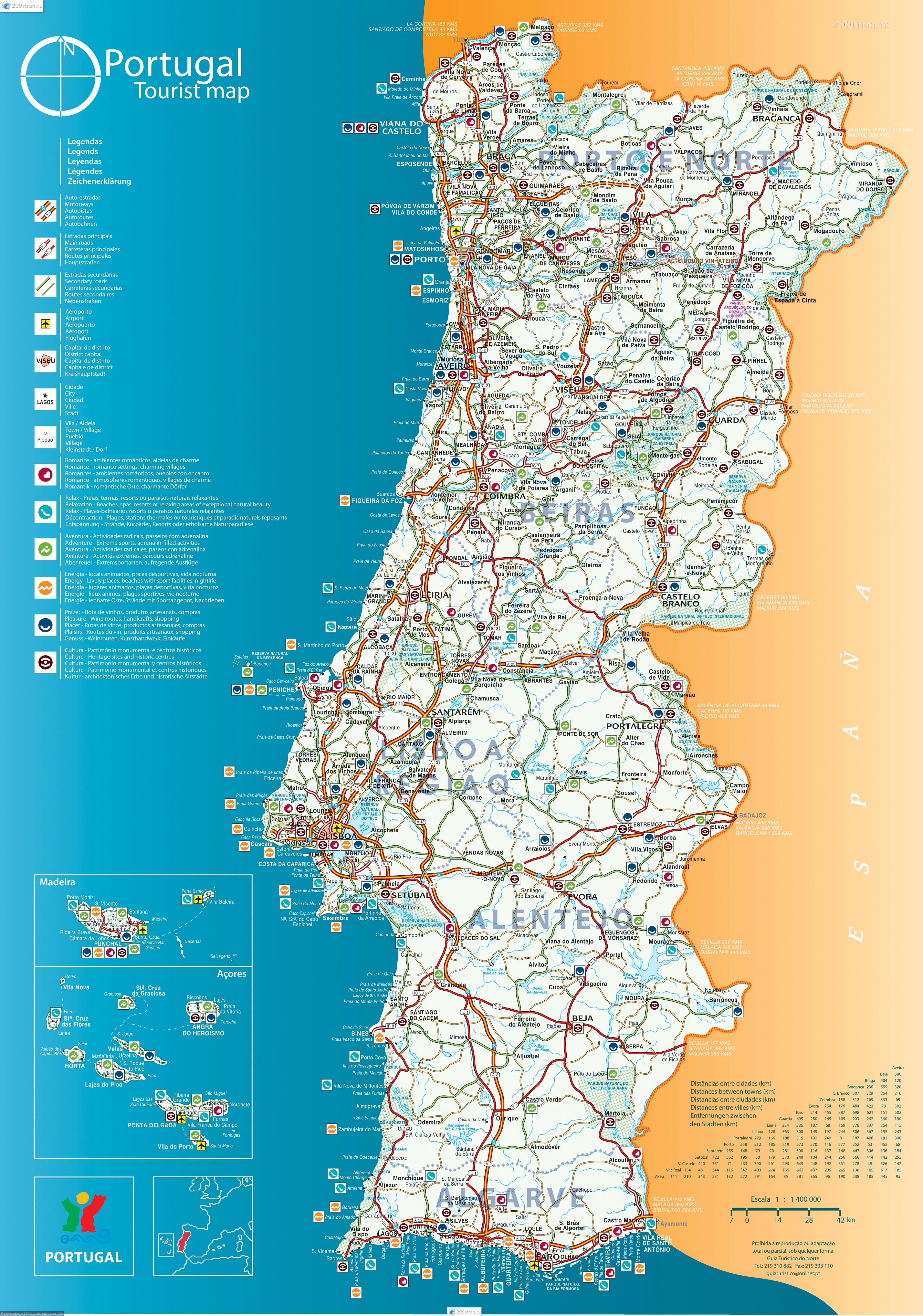
Map of Portugal transports. Portugal transports map (Southern Europe - Europe) to print. Portugal transports map (Southern Europe - Europe) to download. Transport in Portugal is well-developed and diversified. Portugal has a 68,732 km (42,708 mi) network of roads, of which almost 3,000 km (1,864 mi) are part of a 44 motorways system as its shown in Portugal transports map. Brisa is the largest highway management concessionaire. With 89,015 km2, Continental Portugal has 3 international airports located near Lisbon, Porto and Faro. The national railway system service is provided by Comboios de Portugal. The major seaports are located in Leixões, Aveiro, Figueira da Foz, Lisbon, Setúbal, Sines and Faro.
Portugal offers a wide variety of transportation services such as trains, buses, trams, metros, taxis, and planes as its mentioned in Portugal transports map. Public transport in Portugal is safe, clean, mostly reliable and affordable. Locals tell us that the best way to explore all the incredible places to visit in Portugal will be through the national train system Comboios de Portugal, or CP. Comboios de Portugal connects both major cities and local towns. Run by multiple companies, buses are an efficient way to get between cities and other top places to visit in Portugal. Lisbon and Porto both have really well-run, safe underground metro systems (Metropolitano de Lisboa in Lisbon and Metro do Porto in Porto). Locals say they are also pretty cheap. A one-way ticket in Porto is €1.20 if you are in the central zone or Zone 2 (though Zones 3 and 4 are slightly more expensive).