search
Portugal rain map
Map of Portugal rain. Portugal rain map (Southern Europe - Europe) to print. Portugal rain map (Southern Europe - Europe) to download. Annual average rainfall in the mainland varies from just over 3,000 mm (118.1 in) in the northern mountains to less than 300 mm (11.8 in) in the area of the Massueime River, near Côa, along the Douro river as its shown in Portugal rain map. Mount Pico is recognized as receiving the largest annual rainfall (over 6,250 mm (246.1 in) per year) in Portugal, according to Instituto de Meteorologia (English: Portuguese Meteorological Institute). In the extreme northwest, much of the Minho receives 40 to 80 inches (1,000 to 2,000 mm) of precipitation, with more than 100 inches (2,500 mm) falling on mountain slopes. Inland, lee slopes are arid, receiving at most 20 inches (500 mm), much of which is lost through high evaporation rates.
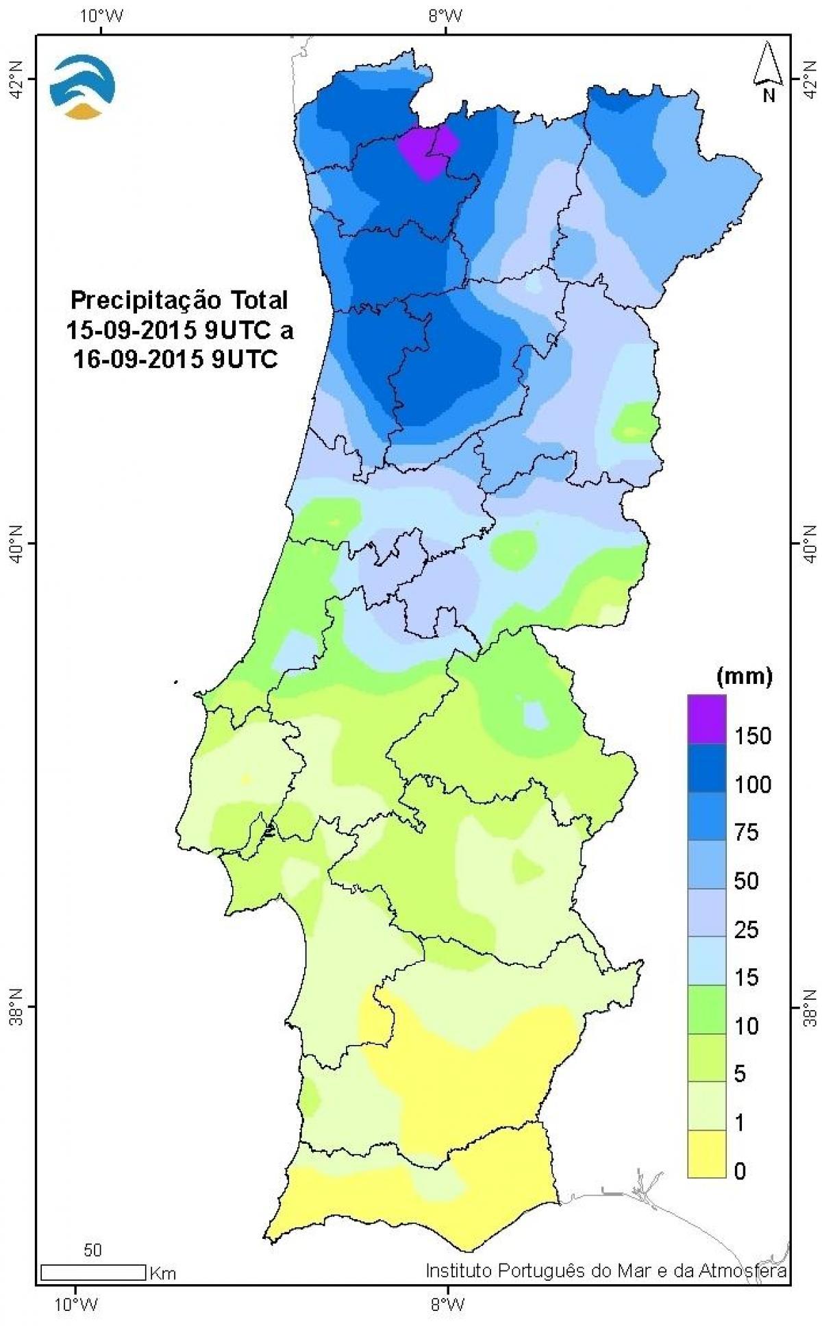
Mean annual precipitation is slightly more than 20 inches (500 mm) along the coast and a bit higher in the mountains of the Algarve as its mentioned in Portugal rain map. Nevertheless, there is considerable climatic variability from one year to the next. In the north, an oceanic climate prevails: cool summers and rainy winters (average rainfall 125–150 cm/50–60 in annually), with occasional snowfall. Central Portugal has hot summers and cool, rainy winters, with 50–75 cm (20–30 in) average annual rainfall. The southern climate is very dry, with rainfall not exceeding 50 cm (20 in) along the coast.