search
Portugal geography map
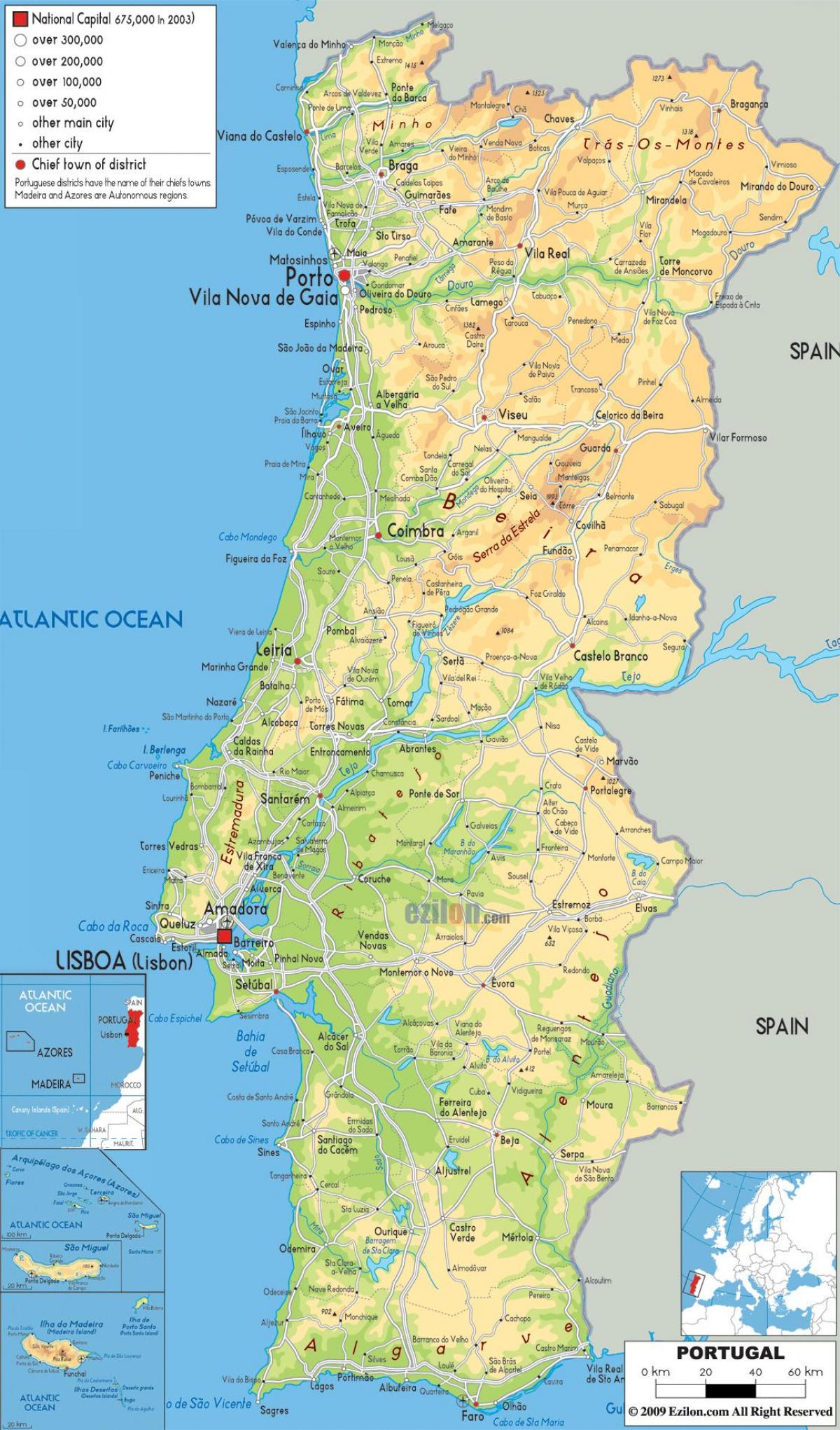
Map of Portugal geography. Portugal geography map (Southern Europe - Europe) to print. Portugal geography map (Southern Europe - Europe) to download. Portugal is the westernmost point of Europe and lies on the west coast of the Iberian Peninsula. The long Atlantic coastline is popular with visitors and locals alike. Surfers are drawn to the strong surf in the west, and the warm, sandy beaches in the south are a haven for tourists. The geography of Portugal is generally mountainous, especially in the north of the country where the Serra da Estrela mountain range dominates as its shown in Portugal geography map. Portugal highest point on the mainland is found at Torre in the Serra da Estrela mountain range, which reaches 6,539 feet (1,993 metres). Portugal’s lowest elevation is found at the coastline of the Atlantic Ocean. The highest point in all of Portugal is found in the Azores at Mount Pico, which measures 7,713 feet (2,351 metres).
Portugal is a costal nation with nearly 1800 km of coastline and, including the Azores and Madeira, the country has a total area of about 92,000 sq km of which approximately 91,500 sq km is land and 500 sq km is water. Portugal has 5 major rivers as its mentioned in Portugal geography map; The Mondega begins in the Serra da Estrela which are the highest mountains in mainland Portugal. Douro, Miho and the Guadiana all rise in Spain and flow into the Atlantic. The main river the Tagus (Tejo) also originates in Spain and meets the Atlantic near Lisbon and splits the country into two geographically very different areas. Northern Portugal is mountainous and hilly and characterised by many small farms and vineyards. To the south the landscape is dominated by rolling hills and plains and the climate is warmer and drier than the north.


