search
Portugal ports map
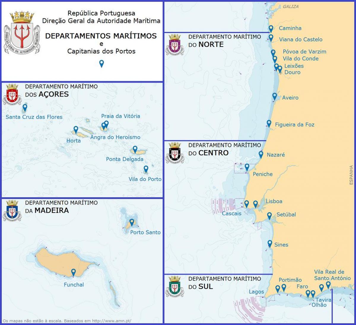
Ports in Portugal on map. Portugal ports map (Southern Europe - Europe) to print. Portugal ports map (Southern Europe - Europe) to download. There are five key ports in Portugal as its shown in Portugal ports map: Aveiro and the port of Douro and Leixões in the north, and Lisbon, Setúbal and Sines in the south. Apart from these, there are also ports in the Autonomous Regions of Madeira and Azores, and some small ports that are managed by the main ones: Viana do Castelo, managed by Douro and Leixões; Figueira da Foz, managed by Aveiro; and Algarve, managed by Sines. The government has put in place a joint board of directors to manage the ports of Lisbon and Setúbal in what could be seen as a step to join these two ports, something that has been under discussion for a long time. The key ports have capacity for all sorts of facilities, although they tend to specialise in some types of cargo ahead of others. Douro and Leixões and Lisbon have the capacity for all types of cargo, having specialised facilities for: containers; oil and gas; bulk; general cargo; and cruises.
Sines is the main Portuguese port for oil and gas, but also has the largest container terminal as its mentioned in Portugal ports map. Setúbal specialises in roll-on, roll-off (ro-ro) and general cargo. Sines is Portugal main transhipment port, stretching its influence into the centre (Estremadura) of Spain. The government is announcing investment in a new and modernised railway to improve the current link between the ports of Sines, Setúbal and Lisbon and Spain. The main ports in Portugal underwent a large change in their organisation model around 20 years ago. The main port authorities were transformed from state-integrated public entities to limited liability companies, although at the moment they are still wholly owned by the state.


