search
Azores Portugal map
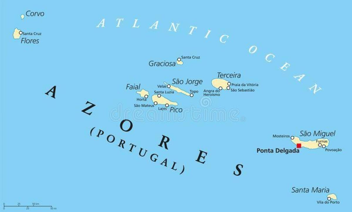
Map of the Azores Portugal. Azores Portugal map (Southern Europe - Europe) to print. Azores Portugal map (Southern Europe - Europe) to download. The Archipelago of the Azores (UK /əˈzɔrz/ ə-zorz, US /ˈeɪzɔrz/ ay-zorz; Portuguese: Açores, IPA: [ɐˈsoɾɨʃ]) is composed of nine volcanic islands situated in the North Atlantic Ocean, and is located about 1,500 km (930 mi) west of Lisbon and about 1,900 km (1,200 mi) southeast of Newfoundland as you can see in Azores Portugal map. The islands, and their economic exclusion zone, form the Autonomous Region of the Azores, one of the two autonomous regions of Portugal. Its main industries are: agriculture, dairy farming (for cheese and butter products primarily), livestock ranching, fishing and tourism, which is becoming the major service activity in the region; added to which, the government of the Azores employs a large percentage of the population directly or indirectly in many aspects of the service and tertiary sectors.
There are nine major Azores islands and an islet cluster, in three main groups. These are Flores and Corvo, to the west; Graciosa, Terceira, São Jorge, Pico and Faial in the centre; and São Miguel, Santa Maria and the Formigas Reef to the east. They extend for more than 600 km (370 mi) and lie in a northwest-southeast direction. The vast extent of the islands defines an immense exclusive economic zone of 1,100,000 km2 (420,000 sq mi) as its shown in Azores Portugal map. The westernmost point of this area is 3,380 km (2,100 mi) from the North American continent. All the islands have volcanic origins, although some, such as Santa Maria, have had no recorded activity since the islands were settled. Mount Pico, on the island of Pico, is the highest point in Portugal, at 2,351 m (7,713 ft). The Azores are actually some of the tallest mountains on the planet, measured from their base at the bottom of the ocean to their peaks, which thrust high above the surface of the Atlantic.
The Azores are divided into 19 municipalities (concelhos); each municipality is further divided into parishes (freguesias), of which there is a total of 156 in all of the Azores as its mentioned in Azores Portugal map. There are five cities (Portuguese: cidades) in the Azores: Ponta Delgada and Ribeira Grande on the island of São Miguel; Angra do Heroísmo and Praia da Vitória on the island of Terceira, and Horta on Faial. Three of these Ponta Delgada, Angra and Horta are considered capital/administrative cities to the regional government: homes to the President (Ponta Delgada), the Judiciary (Angra) and the Regional Assembly (Horta). Angra also serves as the ecclesiastical centre of the Roman Catholic Diocese of Angra.


