search
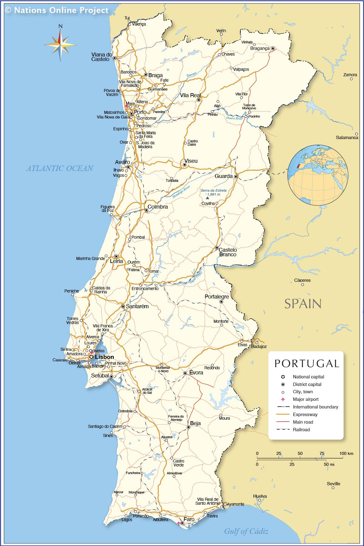
Portugal country map
Map of Portugal and surrounding countries. Portugal country map (Southern Europe - Europe) to print. Portugal country map (Southern Europe - Europe) to download. Portugal is located on the Iberian Peninsula, in South Western Europe. Portugal is geographically positioned in the Northern and Western hemispheres of the Earth. Situated in the westernmost part of Europe, Portugal is bordered by Spain in the north and east; and by Atlantic Ocean in the south and west as its shown in Portugal country map. The small archipelagos of Azores and Madeira are in the south and southwest of Portugal in the Atlantic Ocean. Portugal shares its maritime borders with Morocco. Portugal holds claim to the disputed territory of Olivença in the Portuguese-Spanish border.
Historically, Portugal and Spain were long-standing enemies, but in recent years, they have enjoyed a much friendlier relationship and in 1986, they entered the European Union together. Morocco is Portugal current primary trade partner in the Arab world and the second in Africa, following Angola which was a former colony of Portugal. In 2015, Morocco imports from Portugal increased by 18.5 percent while exports grew by 12.2 percent as its mentioned in Portugal country map. Morocco, as an important gateway to Africa now has great opportunities to attract investment and seek Portuguese partners.