search
Portugal physical map
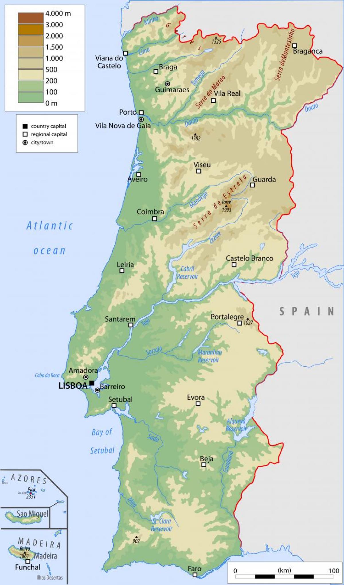
Physical map of Portugal. Portugal physical map (Southern Europe - Europe) to print. Portugal physical map (Southern Europe - Europe) to download. Portugal occupies one-sixth of the Iberian Peninsula at Europe southwestern perimeter. To its north and east is Spain, which makes up the rest of the peninsula; to the south and the west is the Atlantic Ocean; and to the west and southwest lie the Azores (Açores) and the Madeira Islands, which are part of metropolitan Portugal. Portugal is not a large country, but it offers a great diversity of physical geography, ranging from low-lying coasts and plains to the Estrela Mountains, which rise to nearly 6,500 feet (2,000 metres) as its shown in Portugal physical map.
With Spanish Galicia, northern Portugal comprises the mountainous border of the Meseta (the block of ancient rock that forms the core of the Iberian Peninsula); southern Portugal also contains extensive areas of limestone and other sedimentary strata, mostly plateaus or plains as its mentioned in Portugal physical map. Other physical features link Portugal with Spain: its major rivers Douro, Tagus (Rio Tejo), Guadiana rise in the central Meseta before draining west (or, in the case of the Guadiana, south) to the Atlantic, while the proximity of the Meseta affects the climate and increases the rainfall of the northern Portuguese interior, contributing to that region verdant vegetation.


