search
Portugal climate map
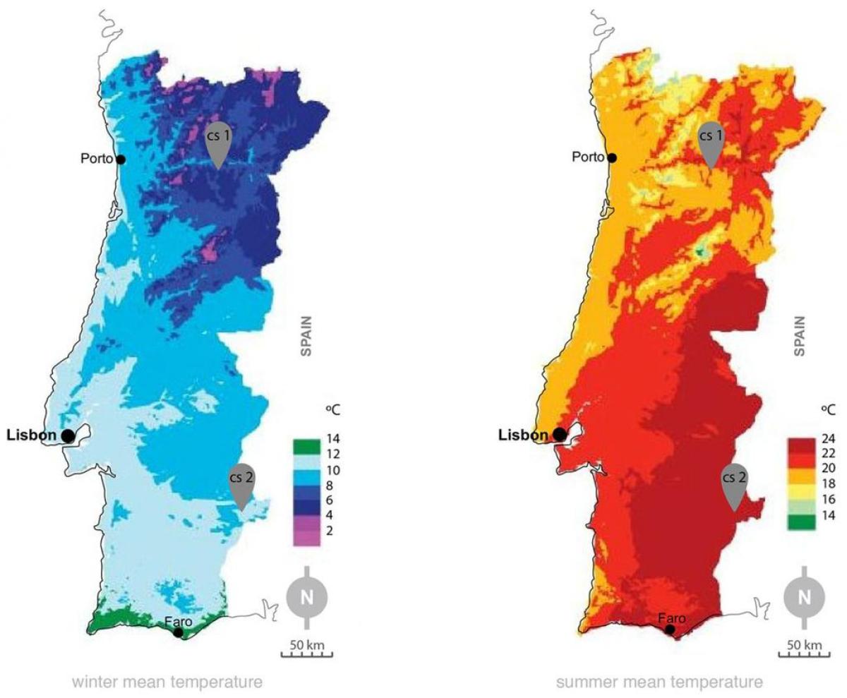
Climate map of Portugal. Portugal climate map (Southern Europe - Europe) to print. Portugal climate map (Southern Europe - Europe) to download. Portugal is defined as a Mediterranean climate (Csa in the south, interior, and Douro region; Csb in the north, centre and coastal Alentejo; and also Semi-arid climate or Steppe climate (Bsk in certain parts of Beja district) according to the Koppen-Geiger Climate Classification), and is one of the warmest European countries: the annual average temperature in mainland Portugal varies from 12 °C (53.6 °F) in the mountainous interior north to over 18 °C (64.4 °F) in the south and on the Guadiana river basin as its shown in Portugal climate map. The Algarve, separated from the Alentejo region by mountains reaching up to 900 metres in Pico da Foia, has a climate similar to that of the southern coastal areas of Spain or Southern California.
Climate, through its effect on vegetation, divides Portugal. As in Spain, three sets of influences are involved: Atlantic, continental (Mesetan), and Mediterranean as its mentioned in Portugal climate map. The Atlantic climate predominates overall, putting most of the country into the humid zone of the Iberian Peninsula; this is especially true in the northwest, where the climate is mild and rainy. In the interior, continental influences increase the duration of the summer drought to more than a month and intensify winter severity. High-pressure conditions from the Spanish Meseta or from Siberian anticyclones bring very cold temperatures. Mediterranean, Saharan, and oceanic influences produce seasonal precipitation, occasional dry winds, and thermal equability, respectively, in the Madeiras. Climate varies markedly with altitude.


