search
Portugal rivers map
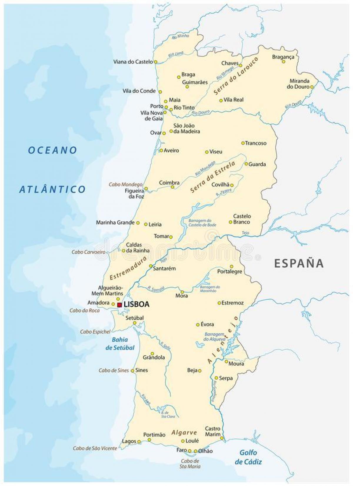
Portugal river map. Portugal rivers map (Southern Europe - Europe) to print. Portugal rivers map (Southern Europe - Europe) to download. All of Portugal’s main rivers flow from Spain over the edge of the Meseta in a series of defiles (narrow gorges), and their usefulness, either for navigation or as routeways for roads and railways, is thus limited. The Douro, which extends some 200 miles (300 km) in the country, has been made navigable from near Porto to the Spanish frontier. In its upper reaches, the Douro riverbed drops 16 feet (5 metres) per mile in gorges 90 to 160 feet (30 to 50 metres) deep, a navigability problem resolved by locks built into five dams, including one that is 115 feet (35 metres) high as its shown in Portugal rivers map. The longest river wholly in the country is the 137-mile (220-km) Mondego River, which rises in the Estrela Mountains.
The Tagus (Spanish: Tajo [ˈtaxo]; Portuguese: Tejo [ˈtɛʒu]; Latin: Tagus; Ancient Greek: Τάγος Tagos) is the longest river on the Iberian Peninsula. It is 1,038 km (645 mi) long, 716 km (445 mi) in Spain, 47 km (29 mi) along the border between Portugal and Spain and 275 km (171 mi) in Portugal as its mentioned in Portugal rivers map, where it empties into the Atlantic Ocean near Lisbon. Other mainly Portuguese rivers include the Vouga, Sado, and Zêzere (a tributary of the Tagus). Like the Mondego, all are navigable for short distances. Rich silt land (campo) in the lower Tagus valley is the result of regular flooding, which is especially severe when strong southerly gales drive high seas up the estuary. The Guadiana, which flows south into the Gulf of Cádiz, forms part of the frontier with Spain, as does the Minho in the north.


